
Could These Fields Be Built On? W&F Maps Now Live
Westmorland & Furness Council (W&F) is drawing up a new Local Plan to guide development across the area for the next 20 years — and several sites in and around Levens have now been suggested for future building.
These sites have been submitted by developers and landowners in response to what’s known as a ‘Call for Sites’. The interactive maps showing all these suggestions were published in May and are now available for anyone to view:
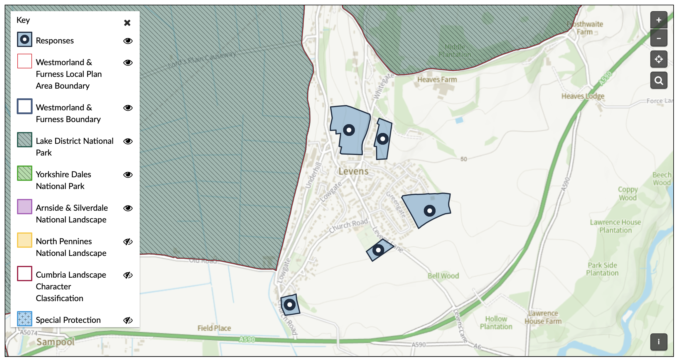
To be clear, none of these sites have been chosen yet. This is just stage one: the Council is now reviewing what’s been submitted to see which plots are realistic candidates for development. Some may be ruled out due to things like protected status or lack of access.
Once that list is narrowed down, a full public consultation will follow — likely in the autumn. The Parish Council has confirmed it will take an active role in that process, and villagers will have a chance to comment before anything is decided.
This is an early but important stage in shaping how Levens might change in the years ahead — so if you’re curious, take a look at the maps and keep an eye out for the consultation later in the year.